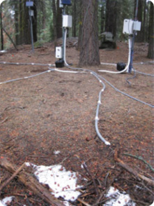
A better understanding of surface water budgets in remote landscapes warrants closer monitoring of moisture and temperature variability in near surfaces soils. As part of the Southern Sierra Critical Zone Observatory (CZO), investigators from University of California deployed approximately 150 soil moisture, soil water potential and temperature sensors within the root structure of an individual white fir tree (Abies concolor) located in the Kings River Experimental Watershed (KREW).
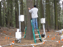
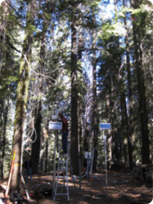
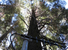
These sensors complement sap flow measurements in the trunk, leaf water potential measurements in the canopy, and snow depth measurements, to enable the Southern Sierra CZO researchers to investigate how soil environmental stresses (water, temperature, nutrients) impact forest ecosystems across the rainfall-to-snow-dominated transition zone. A wireless sensor network was implemented which has several advantages in investigating dynamic environmental variables in remote landscapes and offers a promising approach to realize the full potential of environmental monitoring.
In the Mediterranean climate of the Sierra Nevada, snow pack persists well into the spring after precipitation has effectively stopped. With the onset of summer and continued dry conditions, snow quickly melts, and soil profiles dry out as shrubs and trees deplete the available soil water. We have captured the dynamics of the soil profile desiccation at various depths beneath the snow pack as it went from saturated to very dry conditions. Monitoring of sap flow and periodic leaf water potential measurements, we tracked the activity of the tree as it responded to changing available moisture in the root zone. The sensors were reactive to moisture and temperature variations, and the wireless systems met the goal of providing real time informative data on dynamic responses of soil moisture to precipitation, snow melt and changes in vegetative demand. We hope to demonstrate here the initial phase of a multi-year deployment of soil moisture sensors as a critical integrator of hydrologic/ biotic interaction in a forested catchment as part of a wider effort to document changing ecosystem response to changing environmental inputs.
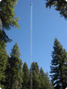
Time lapse photography of the surface snow dynamics at the site, alongside measurements of snow depth and soil moisture within the plot may lead to increased understanding of spatial patterns of root uptake in response to changing moisture inputs at the surface.
Time Lapse Movie